


Bologna water tour
Updated on 07 October 2024 From Bologna Welcome
Ever since Medieval times, water has been an essential source of wealth and economic development for Bologna. During the 12th century, in fact, Bologna had the fifth highest population among European cities and was the main textile production hub in Italy thanks mostly to its canals, used mainly for silk mills which have been reconstructed at the Industrial Heritage Museum (Museo del Patrimonio Industriale).
Nowadays, however, most of the canals have been buried and traces of the capillary water management system can basically only be found in maps. Nonetheless, it is possible to appreciate just how much water could be found all over the city by enjoying a walk to see the main places of the “city water system”.

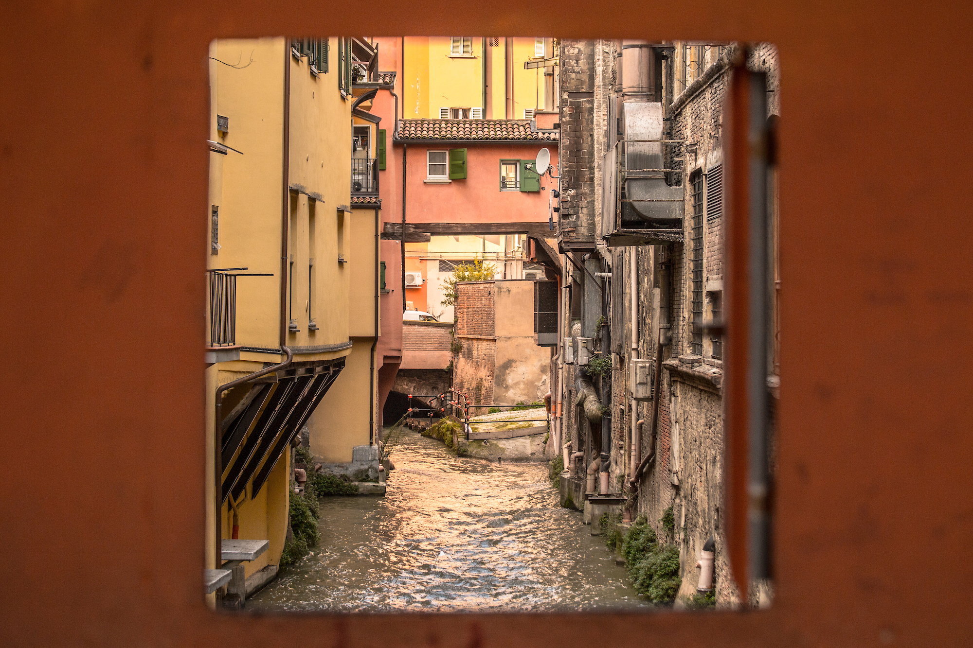
Starting at the Fountain of Neptune, walk along the central streets as far as via delle Moline where the canals of the old city used to be. At the crossroads with via Capo di Lucca, you can hear the sound of the Moline Canal Drop, whose energy was used to drive the wheat millstones. We then move on to via Piella to admire the little window on the Moline Canal and the bridge over the canal, both with panoramic views of the active waterway.
This corner of the city is known as "little Venice" for the unexpected surprise of finding a water canal running through the city. The invitation here is to stop and open the small window in the wall, admire the incredible view and lose yourself in the sound of the water flowing beneath the typical Bologna houses.
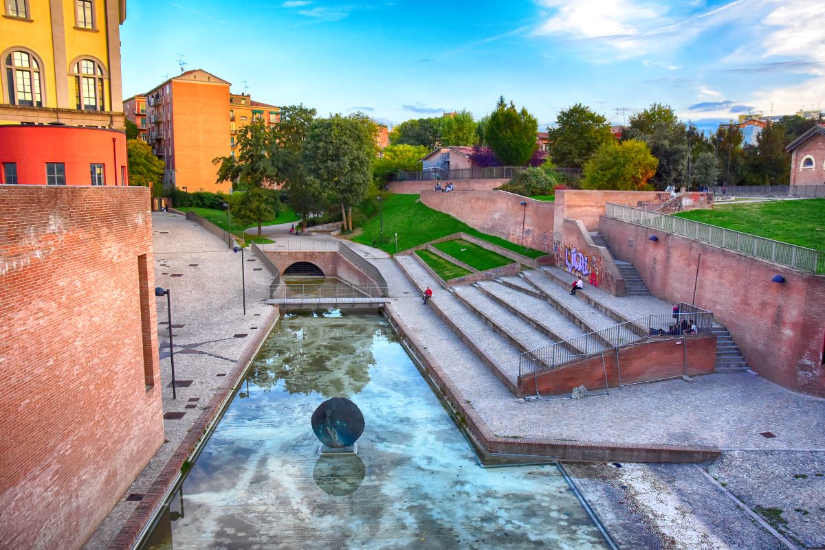
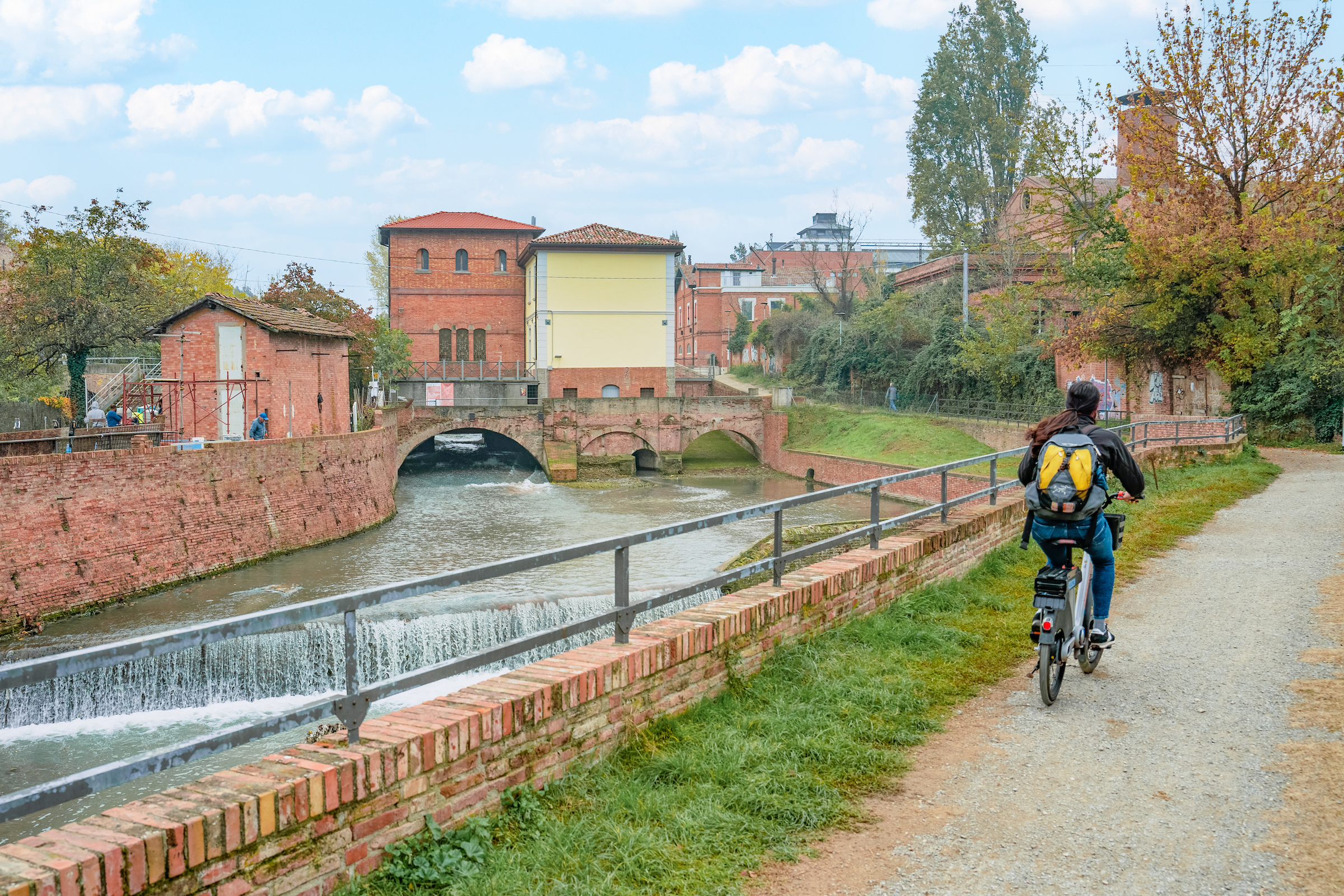
Heading west, you reach the Cavaticcio Park and canal, which used to feed the Navile waterway and flowed out from the Reno canal. In this area, water which originate from the Reno Canal jumped as much as 15 metres, producing abundant energy that was distributed to the numerous factories that existed in this area since the 12th century.
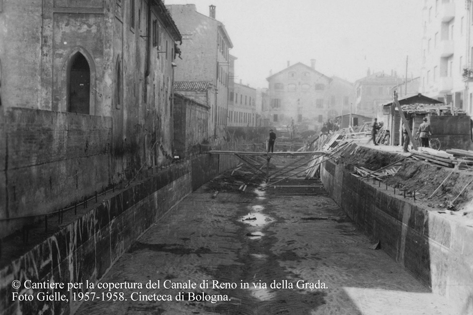
We then reach via Riva di Reno, where, as its name suggests, the Reno Canal once flowed (buried in the 1950s and now uncovered as part of the public works for the Bologna tram) and via della Grada to the headquarters of the Reno and Savena Canal Consortia in Bologna.
An example of an hydraulic machine that can be visited today is the Opificio delle Acque (also known as the Opificio della Grada), which for centuries governed the flow of water to distribute it to the various production, industrial, craft and agricultural activities, and preserved the city from the floods to which it was inevitably subject.
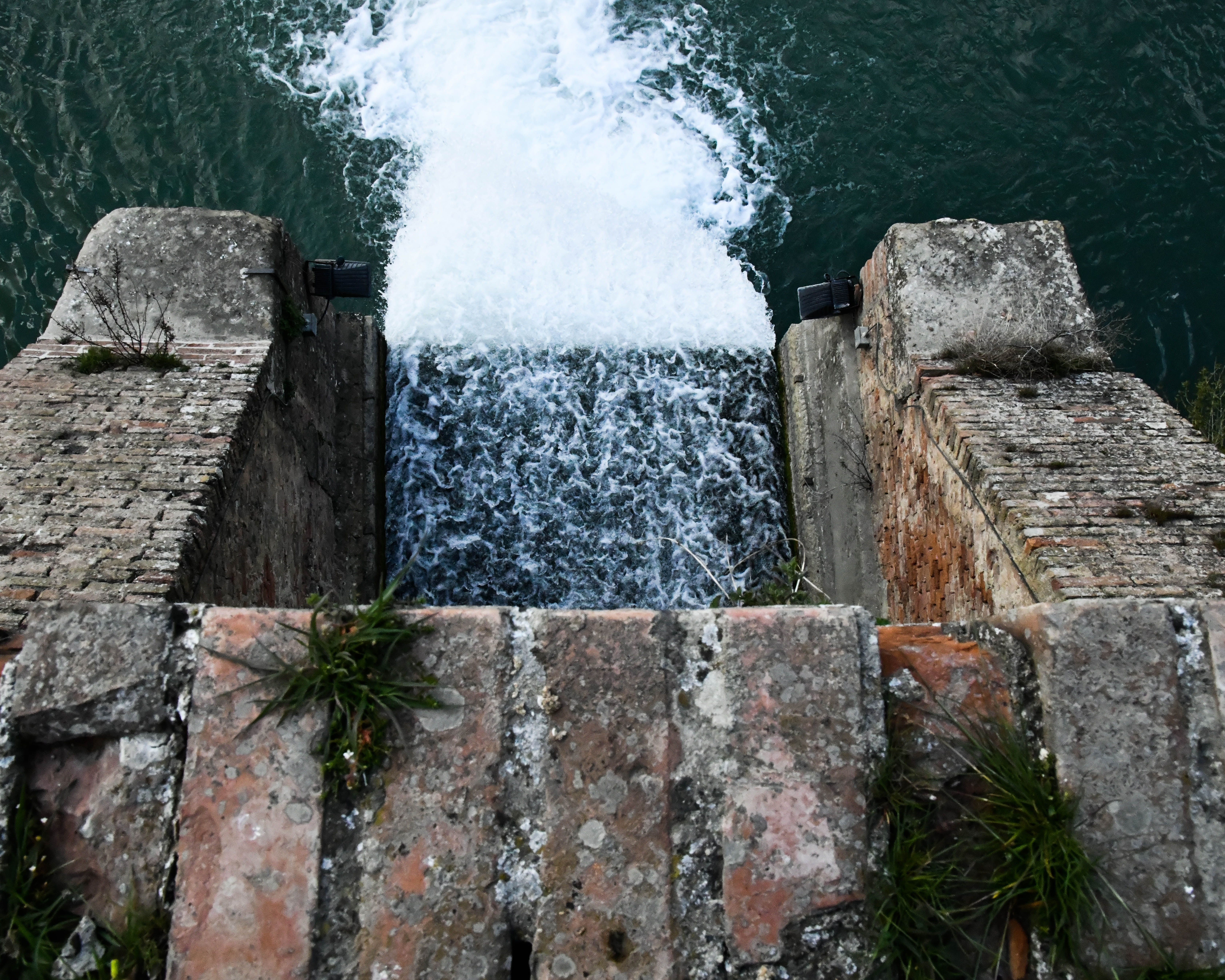
The journey through the waters of Bologna continues outside the walls of the city centre, through two routes. The first, along the cycle path of via Sabotino, reaches the Casalecchio di Reno Sluice, the oldest hydraulic work in Europe still in operation and used continuously and uninterruptedly, and recognised by UNESCO as a "Heritage Messenger of a Culture of Peace in Favour of Young People".
The second one, instead, branches off beyond Bologna's central station: from the Villa Angeletti park, one can follow the course of the Navile canal, which since the Middle Ages constituted the main waterway connecting Bologna and the river Po.
The Navile canal, bordered by the cycle path of the same name, remained in use until after World War II, and along its banks stood the productive settlements that exploited the energy provided by the water with shovel wheels, such as furnaces, mills and small power stations. The route passes by the Sostegno del Battiferro, Torreggiani, Landi, Grassi and the Corticella Bridge.
Check the map and network of active channels on the Canali di Bologna website
| Brochure | Hidden canals in Bologna | Download |


Sign up for our newsletter and stay updated on events and offers. Receive a 10% discount code to use on selected experiences
Subscribe